Moving up the river from the Mandan villages, they passed the confluence of the Yellowstone with the Missouri, and entered a country where Lewis observed "immence herds of Buffaloe, Elk, deer & Antelopes feeding in one common and boundless pasture." Grizzly bears charged the men hunting them. Lewis commented that he would "reather fight two Indians than one bear." River navigation became more difficult. During a fierce windstorm, the pirogue that carried important records and instruments began filling with water and nearly capsized. Sacagawea, who was aboard, saved many items as they floated within her reach. Near the end of May, the great Rocky Mountains came into view. The river's current grew stronger. The explorers had to abandon the paddles and tow the heavy canoes with rawhide ropes while walking along the shoreline. When river banks gave way to cliffs the men had to wade in the water, pushing and pulling the boats upstream.
In early June, the explorers reached a point where the Missouri seemed to divide equally into northerly and southerly branches. Here they spent nine days in concluding that the south branch was the true Missouri. Lewis named the north fork the Marias River, and scouted ahead with a small advance party following the south fork until he heard waterfalls. The Indians at Fort Mandan had told them about the falls of the Missouri, so Lewis knew he was on the right stream.
Here, in the vicinity of present-day Great Falls, Montana, the expedition had to portage 18 miles around a series of five cascades of the Missouri. The men attached cottonwood wheels to the canoes to push them overland. The weather was hot, with intermittent squalls pelting the party with large, bruising hailstones. Transporting the heavy boats and baggage up the steep incline from the river and traversing the long stretch of prairie lands was an exhausting ordeal. Prickly pear spines penetrated their feet through moccasin soles, adding to the difficult and fatiguing travel.
After shuttling canoes and baggage along this portage for three weeks, a camp was established above the falls at "White Bear Island." They had brought along a metal framework over which they stretched hides to make a large, light boat to resume their journey on the river. The plan failed when stitches in the hides leaked water. They had to abandon the framework and make two more cottonwood canoes.
West of the Divide: July 1805 to November 1805
In July 25, the expedition arrived at a place where the Missouri divided into three forks. The southeast branch they named the Gallatin, for the Secretary of the Treasury. The southerly one was named the Madison, for the Secretary of State. The westerly branch became the Jefferson River, "in honor of that illustrious personage Thomas Jefferson President of the United States." Because it flowed from the west the captains decided to follow the Jefferson. Learning from Sacagawea that they were now within traditional food-gathering lands of her people, Lewis went ahead of the main party seeking the Shoshonis. In the middle of August he reached a spring in the mountains which he called "the most distant fountain" of the Missouri. Just beyond was a saddle in a high ridge (today's Lemhi Pass), from which Lewis saw towering, snow-covered mountains to the west. A brook at his feet ran westward and he knew he had crossed the Continental Divide. The brook was one of many tributary streams of today's Snake River, which in turn joined the Columbia.
Immediately west of the Continental Divide, Lewis came upon two Shoshoni women and a girl who were digging edible roots. Lewis gave them presents, and soon they were joined by a large number of Shoshoni men on horseback. Returning from this scouting trip accompanied by a number of Shoshonis, Lewis rejoined Clark and the main party. The explorers formed a camp with the Indians a few miles south of present-day Dillon, Montana, which they named "Camp Fortunate." Here, Sacagawea found a long-lost childhood girlfriend. The girl had been with Sacagawea when both were captured, but had escaped and returned to her people. Sacagawea learned that her own brother, Cameahwait, was now chief of the tribe. It was an emotional scene when brother and sister were reunited.
Thinking ahead to the return journey Captain Lewis ordered the canoes submerged to "guard against both the effects of high water and that of fire. The Indians promised to do them no intentional injury." The party then proceeded across the Continental Divide to the main village of the Shoshonis. With Sacagawea providing vital service as interpreter, a Shoshoni guide was hired, and trading with the Indians for riding and pack horses was successful. After a short stay with their new friends, the now horse-mounted corps followed their venerable guide, Old Toby, into the "formidable mountains."
September found the half-starved explorers surviving on horse meat while following an ancient Indian route, the Lolo Trail, across the Bitterroot Mountains, in modern Montana and Idaho. Here, they encountered fallen timber, bone chilling cold, and slippery, hazardous travel during an early season snowstorm. Descending the west slope of the mountains, they reached a village of the Nez Perce. Here, the natives provided a feast of salmon, roots, and berries. The ravenous explorers found to their dismay that this unaccustomed diet made them extremely ill.
The group reached today's Clearwater River where they branded and left their horses in the care of the Nez Perce until their return. They built new canoes and proceeded through boulder-strewn rapids, making speedy but risky progress. In early October they reached the Snake River, and then on October 16, the Columbia. Down that mighty river they floated reaching the now inundated "Great Falls of the Columbia," (Celilo Falls) near the modern Oregon town of The Dalles. Here, and also when confronted by the raging rapids within the Cascade Mountains that Clark called the "Great Shute," they again were forced into toilsome portages.
On November 2, they drifted into the quiet upper reaches of tidewater on the Columbia. Clark, on November 7, wrote: "Great joy in camp we are in View of the Ocian, this great Pacific Octean which we been so long anxious to See." They were still 25 miles upstream, and what they actually saw were the storm-lashed waves of the river's broad estuary. For the next nine days savage winds blew, ocean swells rolled into the river, and the rain poured down, stranding them in unprotected camps just above the tide at the base of cliffs. In mid-November the captains finally strode upon the sands of the Pacific Ocean near the Columbia's mouth, the western objective of their journey. Clark recorded that 554 days had elapsed, and 4,132 miles had been traveled since leaving Wood River.
On the Pacific: November 1805 to March 1806
Captain Lewis carried with him a letter of credit signed by Jefferson, guaranteeing payment for the explorers' return by sea via any American or foreign merchant ship encountered in the Columbia River estuary. They saw no ships upon reaching the ocean, nor as their records reveal, would any enter the turbulent river entrance during their four-month stay at the coast. Actually, the captains never seriously intended to return by sea, preferring instead to establish a camp close to the coast. There they hoped to obtain from trading ships " a fresh Supply of Indian trinkets to purchase provisions on our return home."
Due to the absence of game and their unprotected exposure to fierce winter storms on the north shore of the Columbia (Washington State) the party elected to cross the river to the south side (Oregon) where, Indians informed them, elk and deer were numerous. An actual vote of the members was recorded, representing the first American democratically held election west of the Rockies that included the vote of a woman, Sacagawea, and a black man, York.
Crossing the river, they built their 1805-06 winter quarters on a protected site five miles south of modern Astoria, Oregon, naming it Fort Clatsop for their neighbors, the Clatsop Indians. The men spent the winter hunting elk for food and for making elkskin clothing and moccasins to replace their worn buckskins. Lewis filled his journal with descriptions of plants, birds, mammals, fish, amphibians, weather data, and much detailed information on Indian cultures. Clark drew illustrations of many of the animals and plants, and brought his maps of the journey up to date. Sacagawea joined Clark and a few of the men on a trip to the coast to procure oil and blubber from a "monstrous fish," a whale that had washed up on the beach. Enroute, they visited the expedition's salt-making camp at present-day Seaside, Oregon, where several of the men kept a continuous fire burning for nearly a month boiling sea water, to produce twenty gallons of salt.
The Return Journey: March 1806 to September 1806
On March 23, 1806, the explorers started back up the Columbia in newly acquired Indian canoes. At the Great Falls of the Columbia they bartered with local Indians for pack horses, and set out up the north shore of the river on foot. Obtaining riding horses from various tribes along the way, the party reached the Nez Perce villages in May. While camped among the Nez Perce for a month, waiting for the high mountain snows to melt, the captains gave frontier medical treatment to sick and injured Indians in exchange for native foods.
The Nez Perce rounded up the expedition's horses that they had cared for over the winter, easing the captains' concern for adequate transportation as the party resumed its eastward travel in early June. Retracing their outbound trail through the Bitterroots, they were turned back by impassable snowdrifts and made their only "retrograde march" of the entire journey. After a week's delay, they started out again and successfully crossed the mountains. On June 30, they arrived at their outbound "Travelers Rest" camp, eleven miles south of modern Missoula, Montana, where they enjoyed a welcome rest from their toils.
On July 3, 1806, the party separated. Lewis, with nine men, rode directly east to the Great Falls of the Missouri. Then with three men, he traveled north to explore the Marias River almost to the present Canadian border. Lewis and his companions camped overnight with some Blackfeet Indians, who at daylight attempted to steal the explorers guns and to drive off their horses. In describing the ensuing skirmish, Lewis related that he was fired upon by an Indian, which resulted in a near-miss that " being bearheaded I felt the wind of the bullet very distinctly." Lewis afterward would elaborate that two of the Blackfeet were killed during the brief, violent encounter, but that he and his companions miraculously escaped unharmed.
Meanwhile Clark, with the balance of the party proceeded southeasterly on horseback, crossing the Rockies through today's Gibbons Pass. Returning to the Jefferson River (now the Beaverhead River in its upper reach), the submerged canoes were recovered and repaired. Clark placed some men in charge of the canoes while he and the others continued on with the horses, all following the river downstream to the Three Forks junction of the Missouri River.
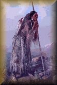
Here, the group divided. The canoe travellers continued down the Missouri to White Bear Island, where they recovered their cached equipment and portaged back around the falls. Clark with the remainder, rode their horses easterly to explore the Yellowstone River. It was during this stage of the journey, while passing through Shoshoni tribal lands that Sacagawea remembered from her childhood, that Clark praised her "great service to me as a pilot." Upon reaching the Yellowstone new canoes were made. Clark assigned three men to drive the horses overland while he and the others drifted down the river. On July 25, 1806, Clark named an unusual rock formation on the south bank of the Yellowstone River (Montana) "Pompy's Tower" in honor of Sacagawea's son.
All of the parties were reunited on August 12 near the confluence of the Yellowstone and the Missouri rivers. Here, Clark learned that Lewis had been shot while searching for game in the brushy shoreline of the Missouri. In his buckskin clothing the captain was mistaken for an elk by a hunting companion. Clark treated and dressed the wound with medicines they carried.
Arriving at the Mandan villages on August 17, the Charbonneau family was mustered out of the expedition. Private John Colter was discharged at his own request to join a fur trapping party bound back up the Missouri. The remainder of the party, accompanied by a Mandan chief and his family, headed down the Missouri on the last leg of the homeward journey.
After September 23, 1806
On September 23, 1806, the tattered Corps of Discovery arrived at St. Louis and "received a harty welcom from it's inhabitants." It had been a great expedition. Jefferson's explorers had covered 8,000 miles of territory over a period of 2 years, 4 months, and 9 days. Its records contributed important new information concerning the land, its natural resources, and its native peoples. Lewis and Clark learned that the surprising width of the Rocky Mountain chain effectively destroyed Jefferson's hoped-for easy connection between the Missouri and Columbia river systems. This finding was the expedition's single most important geographical discovery, resulting in a route over South Pass (Wyoming) during later follow-up trips westward by fur traders and other explorers. There had been plenty of difficulties, but Lewis and Clark were as firm friends as when they started. Congress rewarded the officers and men of the military enterprise, including Toussaint Charbonneau, with grants of land. Sacagawea received no compensation for her services.
On February 28, 1807, President Jefferson picked Lewis to be Governor of Upper Louisiana Territory. His career started well, but controversy involving government finances arose in 1809 culminating with his decision to travel to Washington, D.C., to resolve the dispute. Traveling through Tennessee, Governor Meriwether Lewis on October 11, 1809, died mysteriously from gunshot wounds inflicted while at Grinder's Stand, a public roadhouse. It is not known conclusively whether he was murdered or committed suicide. His grave lies where he died, within today's Natchez Trace National Parkway near Hohenwald, Tennessee.
Clark enjoyed a lifelong, honorable career of public service in St. Louis. On March 12, 1807, Jefferson commissioned him Brigadier General of Militia and Indian Agent for Upper Louisiana Territory. In 1813 he was appointed Governor of Missouri Territory, a position he held until Missouri Statehood in 1820. In 1822 he was appointed Superintendent of Indian Affairs by President Monroe. He was reappointed to this post by each succeeding president, and served in this capacity for the remainder of his life. Admired by many Indians as their friend and tribal protector, General William Clark died of natural causes in St. Louis, September 1, 1838. He is buried in the Clark Family plot at Bellefontaine Cemetery, St. Louis.
Sources Quoted
Boyd, Julian P., et al, eds. The Papers of Thomas Jefferson, 24 vols. to date 1950-1990. Princeton University Press, Princeton, New Jersey.
Jackson, Donald, ed. Letters of the Lewis and Clark Expedition with Related Documents 1783-1854, Second Edition, 2 vols., University of Illinois Press, Urbana, 1978.
Malone, Dumas, ed. Jefferson and His Time, 6 vols., 1948-1981, Little, Brown and Company, Boston.
Moulton, Gary E., ed. The Journals of the Lewis & Clark Expedition, 10 vols. to date 1983-1996. University of Nebraska Press, Lincoln and London.
Thwaites, Reuben Gold, ed., Original Journals of the Lewis and Clark Expedition, 1804-1806, 8 vols. Dodd, Mead, 1904-1905. Arno Press reprint, New York, 1969.

8LEWIS & CLARK TRAIL
The History of the Lewis and Clark Expedition
This page was last updated: February 1, 2010
Copyright © 2000 Larson Century Ranch, Inc. ~ All Rights Reserved
P. O. Box 1982
Clarkston, WA 99403
Telephone: 509-758-5445
FAX: 509-758-5701
E-Mail: Sales@LarsonCenturyRanch.com

Web Design: Design Carte
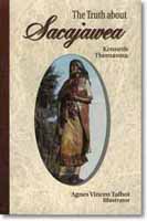
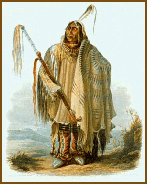
A French-Canadian named Toussaint Charbonneau visited the captains with his young pregnant Shoshoni wife, Sacagawea. Sacagawea's tribal homeland lay in the Rocky Mountain country far to the west. She had been kidnapped by plains Indians five years previously when she was about twelve years old, taken to the North Dakotavillages where she was eventually sold to Charbonneau. Sacagawea spoke both Shoshoni and Minitari, and the captains realized that she could be a valuable intermediary if the party encountered the Shoshonis. She and Charbonneau could be very helpful in trading for horses that would be needed to cross the western mountains.
Moreover, Sacagawea would prove to be a token of truce, assuring the Indians that the expedition was peaceful. Clark later documented this while descending the Columbia River when he noted, "No woman ever accompanies a war party of Indians in this quarter." As a result, the captains hired Charbonneau, who was joined by Sacagawea and their infant son Jean Baptiste Charbonneau, born at Fort Mandan, February 11, 1805. The boy became a favorite of Clark, whom he nicknamed "Pomp," citing his pompous "little dancing boy" antics.
On February 28, 1803, the Congress appropriated funds for a small U.S. Army unit to explore the Missouri and Columbia rivers and tell the western Indian tribes that traders would soon come to buy their furs. The explorers were to make a detailed report on western geography, climate, plants and animals, and to study the customs and languages of the Indians. Plans for the expedition were almost complete when the President learned that France offered to sell all of Louisiana Territory to the United States. This transfer, which was completed within a year, doubled the area of the United States. It meant that Jefferson's Army expedition could travel all the way to the crest of the Rockies on American soil, no longer needing permission from the former French owners.
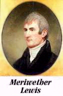
Jefferson selected as leader for the exploring mission an Army captain, 28-year-old Meriwether Lewis. The Jeffersons and Lewises had been neighbors near Charlottesville, Virginia, where Lewis was born August 18, 1774. As a boy he had spent long hours tramping and hunting in the woods and acquiring a remarkable knowledge of native plants and animals. He served in the Virginia Militia when President Washington called it out in 1794 to quell the Whiskey Rebellion. Lewis was having a successful career in the regular army when the newly elected Jefferson summoned him in 1801 to work as his private secretary in the "President's House."
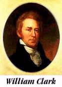
Lewis chose a former army comrade, 32-year-old William Clark, to be co-leader of the expedition. Clark was born August 1, 1770, in Caroline County, Virginia. At the age of 14, he moved with his family to Kentucky where they were among the earliest settlers. William Clark was the youngest brother of General George Rogers Clark, a hero of the Revolutionary War. William served under General "Mad Anthony" Wayne during the Indian wars in the Northwest Territory.
In preparing for the expedition, Lewis visited the president's scientific friends in Philadelphia for instruction in natural sciences, astronomical navigation and field medicine. He also was given a long list of questions to ask of western Indians concerning their daily lives. It was during these organizing endeavors that Lewis, for "20$" purchased Seaman, his "dogg of the newfoundland breed" to accompany him to the Pacific.
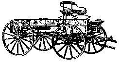
Lewis and Clark reached their staging point at the confluence of the Mississippi and Missouri rivers near St. Louis in December 1803. They camped for the winter at the mouth of Wood River, on the Illinois side of the Mississippi, opposite the entrance to the Missouri River. The two captains recruited young woodsmen and enlisted soldiers who volunteered from nearby army outposts. Over the winter final selections were made of proven men. In the spring, the expedition's roster comprised approximately 45 including some military personnel and local boatmen who would go only part way. Lewis recorded that the mouth of Wood River was "to be considered the point of departure" for the westward journey.
The expedition broke camp on May 14, 1804. Clark wrote in his journal: "I set out at 4 oClock P.M and proceeded on under a jentle brease up the Missouri." The party traveled in a 55-foot long keelboat and two smaller boats called "pirogues." Through the long, hot summer they laboriously worked their way upriver. Numerous navigational hazards, including sunken trees called "sawyers," sand bars, collapsing river banks, and sudden squalls of high winds with drenching rains slowed their progress. There were other problems, including disciplinary floggings, two desertions, a man dishonorably discharged for mutiny, and the apparent appendicitis-caused death of Sgt. Charles Floyd, the only member to die during the expedition. In modern South Dakota, a band of Teton Sioux tried to detain the boats, but the explorers showed their superior armaments, and sailed on.
Early in November they came to the villages of the Mandan and Minitari (Hidatsa) Indians, who lived near present-day Washburn, North Dakota. On the north bank of the Missouri River they found a grove of stout cottonwood trees of the proper size for construction of a log fort. Standing close together, the trees also offered protection from the prairie winds. In four weeks of hard work the men built a triangular shaped fort. Rows of small huts made up two sides; a wall of upright cottonwood logs formed the front. They named it Fort Mandan in honor of the local inhabitants. The party was now 164 days and approximately 1,510 miles distant from Wood River.
The explorers spent five months at Fort Mandan, hunting and obtaining information about the route ahead from the Indians and French-Canadian traders who lived nearby. The expedition's blacksmiths set up a forge and made tools and implements, which were traded for the Indian's garden crops of corn, melons and beans.
Written by:
Irving W. Anderson
Past President of the
Lewis and Clark Trail Heritage Foundation, Inc.
Prelude: to May 1804
In 1803 President Thomas Jefferson won approval from Congress for a visionary project that was to become one of American history's greatest adventure stories. Jefferson wanted to know if Americans could journey overland to the Pacific Ocean following two rivers, the Missouri and the Columbia, which flow east and west, respectively, from the Rocky Mountains. If the sources of the rivers were nearby, Jefferson reasoned that American traders would have a superior transportation route to help them compete with British fur companies pressing southward from Canada.
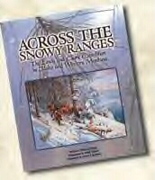
The story of the Lewis & Clark Expedition in the most difficult part of the entire route to the Pacific.
Click Here: Books
Lewis & Clark Expedition